


Breaking the Ice
A Conversation with Astera Resident Thomas Teisberg on breaking the silos limiting action on sea level rise


When Thomas Teisberg began deciphering Earth’s ice sheets, he didn’t expect to find himself nestled in a metaphorical pyramid. With a background in electrical engineering and experience in drone perception systems, he’d been building the tools that collect data used to understand melting ice sheets. But over time, he began to see this work as the bottom layer of a pyramid of activity. He started to become more interested in the layers above — not just the layers of ice — but also the models, projections, uncertainty, and real-world decisions that rest on that foundational data.
Now, as a Resident at the Astera Institute, Thomas is working to close the loop between ice sheet data collection and modeling, with the end goal of enabling better decision-making around sea-level rise. We sat down with him to hear more about how he’s approaching this massive systems problem, why improving uncertainty matters, and the opportunities he sees to catalyze change for the future.
What motivates your work? What is the problem you’re trying to solve?
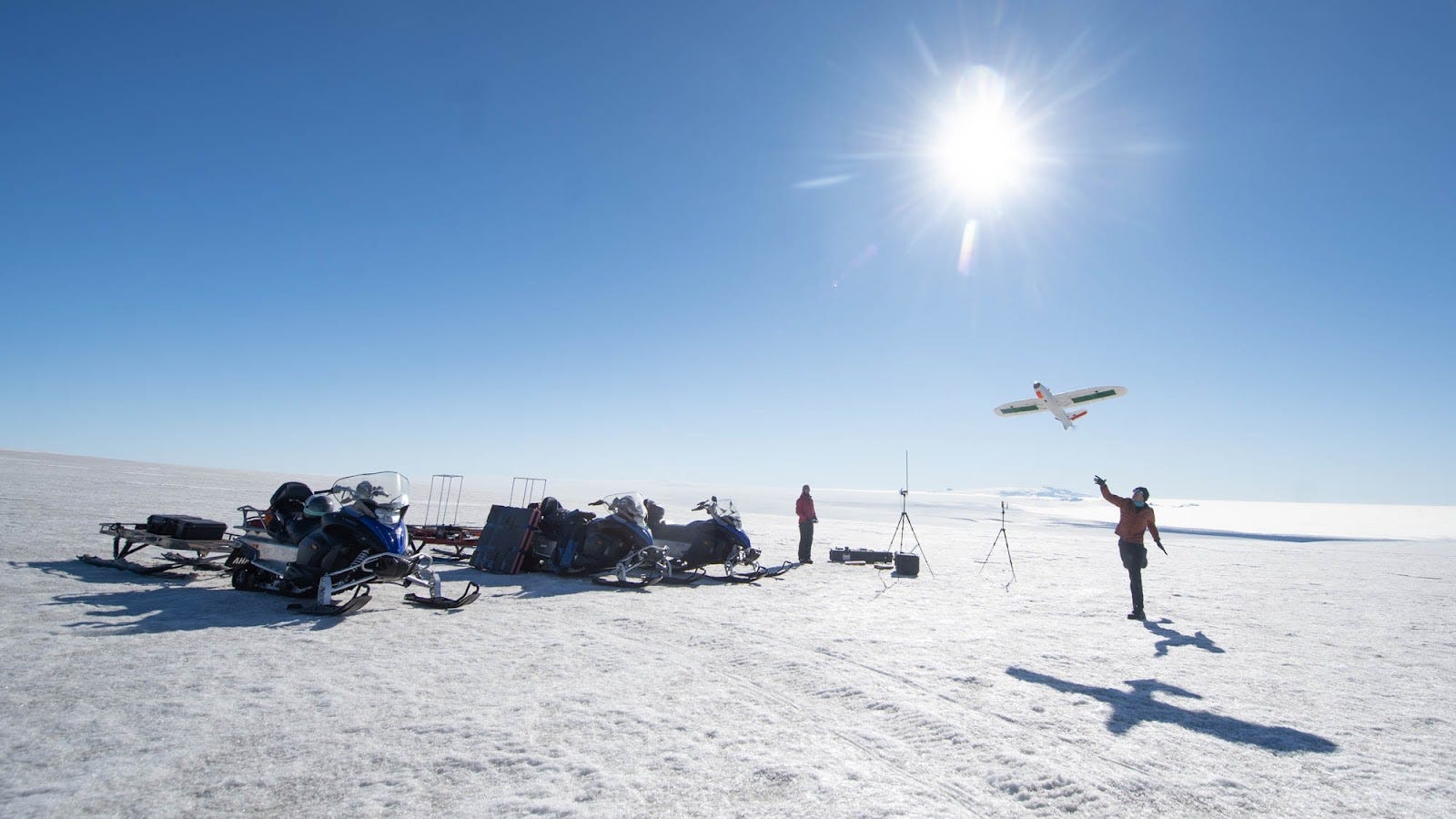
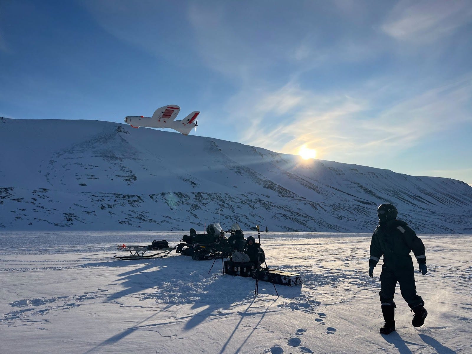
My background is in engineering and radio glaciology, which is a field of research that uses radar to see what’s under the surface of the ice sheets in Antarctica and Greenland; things like bedrock and internal ice layers.
It’s really important to get data to understand the ice sheets of Antarctica and Greenland — this data collection feeds into a much larger system. It ultimately informs sea-level rise projections and the decisions people make based on those projections, like planning decisions a coastal community might make.
Right now, those models are directionally informative — we know that more warming leads to more ice loss and higher sea levels. But they’re limited in their ability to predict exactly how much sea level rise we should expect by a specific date. Under a high-emissions scenario, the IPCC estimates somewhere between 60 cm and 1 meter (roughly 2 to 3 feet) of sea level rise by 2100. Some expert surveys independently suggest over 2 meters (about 6.5 feet) is possible. Sixty centimeters to 2 meters is not a trivial difference. Every 10 cm of sea-level rise is estimated to cost almost a quarter of a percent of global GDP annually in flood damage by the end of the century. That’s trillions of dollars per year.
This level of uncertainty is unacceptable given the potential impact. Most of the uncertainty comes from Antarctica. So if we can better constrain our models there, we can direct billions of dollars to better plan for our future. City, state, and federal governments can have better data to decide how they want to protect against flooding. Better projections can also be used to make critical decisions about where to locate airports, public transit, water and energy infrastructure, and more. By making these decisions correctly the first time — and better estimating the full economic impacts of our current emissions — we can save billions of dollars and hopefully avoid some of the worst impacts of climate change on coastal communities.
Why isn’t this kind of work happening already? What’s been in the way?
We collect incredibly rich data sets using radar, but we generally only use a fraction of the full richness of this data. Most often, we just use it to map bedrock topography under the ice, which goes into climate models as a simple boundary of where the rock ends and the ice starts. But there's so much more we could extract from that data: reflections that hint at subglacial lakes, layers that tell us about ice flow history, signatures that could help us understand temperature or material composition beneath the ice.
The problem is, those insights are often studied in isolation — one glacier, one region — and we haven’t scaled them. There's little infrastructure to automate and integrate those insights across the entire ice sheet. That’s what I’m focused on here: building tools and automated pipelines that can scale isolated insights into broad, usable, repeatable model inputs.
The lack of tooling infrastructure is partly due to a structural problem in academia. You get rewarded for publishing new discoveries, not for scaling infrastructure or automating workflows. That’s true whether you’re working in software or hardware. There are lots of examples of papers that get cited all the time, not because of the discovery in the paper but because of the great methods they used. But they don’t get published because of the methods. Paper with a new discovery based on a new method? Good paper. Paper with really cool new infrastructure that has the potential to drive many new discoveries? It probably won’t get the same attention.
There’s not enough funding, support, or career incentives to build scalable, public data products. That’s where institutions like Astera can play a unique role: helping bridge that gap to further tools for more and better research. This kind of residency program is a unique and meaningful opportunity to address these gaps in a way that most funding isn’t set up to support.
How does better data lead to better models and then ultimately better impact?
I see these tools and data as part of a pyramid of impact. Before my PhD I was working on radar and acoustic systems, mostly for autonomous vehicles, and got curious about how atmospheric and environmental conditions affected sensor performance. That led me to a PhD program at Stanford in a geophysics lab that focused on ice-penetrating radar.
At first, I thought I was just building tools. But the more time I spent in the field, the more I saw how this radar data was just one layer of something much bigger. It was a part of a kind of pyramid. At the bottom, there’s the raw data we can collect with these incredible tools. Above that, there are layers of interpretation, then physical models, then decision-making tools. And finally, there are the decisions themselves — whether that’s deciding where to locate a runway or designing a flood adaptation plan.
I’ve spent a bunch of time at the bottom of that pyramid. And with this opportunity at Astera, I’m moving my way up the stack, taking observational data we have today and improving how we integrate that into models, which will ultimately help us make better decisions at the top. I think we ultimately need more people to move around from layer to layer in this pyramid, and help cross-pollinate ideas. The tools we build here should make that easier.
When there is uncertainty coming from the lower layers, it can cause a lot of issues higher up. It’s hard to overstate how paralyzing that uncertainty can feel. Not just for scientists or policymakers, but for entire communities. When your data says “this could be bad — or really, really bad,” it’s not a clear invitation to act. It breeds anxiety, hesitation, and even apathy.
A lot of sea-level discourse gets polarized — it’s either “the ice is collapsing” or “nothing to worry about.” But the real story is more measured: the ice is melting, and we need to know how fast and by how much. Improving the models is part of that, and so is helping people understand how the models work, what they assume, and where the uncertainty comes from.
There are cultural silos too. Sea-level rise often isn’t the top priority for local governments — it’s slower-moving than heat waves, wildfires, or housing shortages. But it’s still there, especially in infrastructure planning. And one of the challenges is that observationalists, the modeling community, and the planning community often speak different languages. A big part of my work is about making scientific uncertainty more legible, so that it becomes a tool for better decision-making, and not a source of paralysis. My hope is that creating better models can translate to less uncertainty and shrink the gap between what we know and what we do.
How does open science and transparency contribute to trust in this science and these models?
Building trust isn’t just about open-sourcing your code — it’s also about being transparent in how the model works, what assumptions went into it, what uncertainties it accounts for, and what it might be missing. Right now, the range of projections is so wide, in part because different models include different processes. That makes it hard to build a unified front.
We can’t eliminate uncertainty. But we can do a better job constraining it, explaining it, and making sure it's grounded in the full range of data we have available.
Ice sheet science isn’t just an academic curiosity anymore. Real decisions are being made with these projections. We need to professionalize the modeling, reduce the time lag between data and application, and start investing in infrastructure, not just research.
In the ice sheet modeling field, we don’t yet have a sufficiently high level of sustained focus or long-term government funding. That’s where foundations could step in. Philanthropic support could move fast, stay open, and help coordinate the work that already exists into something bigger and more impactful.
And it’s very important that we do it all in the open. The models, the workflows, the choices — we need all of it to be auditable and accessible if we want people to believe in it.
Because at the end of the day, the data isn’t just data — it’s the story we’re telling about the future. And if we can tell that story with more clarity, less uncertainty, and more trust, we can give communities a better way to respond with action.
P.S. Thomas is hiring.
As Thomas starts to build his organization through the Astera Residency, he is looking for a Research Software Engineer to help build the data infrastructure and tooling that will underpin critical future decision-making around sea-level rise. If you or someone in your network is excited about turning complex Earth science data into actionable models to inform global decisions, check out the role. It’s a rare chance to work at the intersection of science, technology, and long-term impact.
Do you have an idea with the potential for tremendous impact that doesn’t fit into existing institutions and funding mechanisms? The Astera Residency might be the right venue to explore it further. Applications for the Fall 2025 cohort are due May 7th.